
Orleans Parish ZIP Coverage
Seventeen ordinary geographic ZIP codes serve Orleans Parish. Neighborhood names are practical clues, not USPS boundaries. Always confirm a full address through USPS By Address and the City Property Viewer.
| ZIP Code | Areas Covered | Post Office | Notes |
|---|---|---|---|
| 70112, 70113 | CBD, Vieux Carré, Central City edge | Downtown routes | Verify the exact block |
| 70114, 70131 | Algiers and English Turn | Algiers stations | Orleans West Bank |
| 70115, 70118 | Uptown, Freret, Carrollton, Riverbend | Uptown and Carrollton | River-side areas |
| 70116, 70117 | French Quarter, Marigny, Bywater, St. Roch | Vieux Carré and Bywater | Historic-core delivery |
| 70119, 70122, 70124, 70125 | Mid-City, Gentilly, Lakeview, Broadmoor | Named local stations | Neighborhood edges overlap |
| 70126-70130 | New Orleans East and downtown riverfront | Chef Menteur, Lake Forest, downtown | Verify station by address |
USPS L007 also associates codes such as 70139, 70148, 70163, and 70170 through 70190 with ordinary codes. These may represent box, finance, unique, or special delivery uses, not a residential district. Do not count an associated code as another neighborhood.
Find Orleans Residents by ZIP
No verified public local portal returns every parcel or voter in one ZIP-wide query. Use a ZIP as a narrowing field for one person or address, not as a bulk resident roll.
- Verify the complete street address with USPS By Address.
- Open Property Viewer by address, owner, or tax bill and capture the situs and parcel.
- Use the Voter Portal's ZIP field only for an individual lookup with the other required identity fields.
- Move to the Orleans Parish street directory after the ZIP narrows the search.
Property Viewer has no confirmed ZIP-wide export, and the public voter portal does not reveal a ZIP-wide list. A lawful voter-file request follows Secretary of State rules and protected-field limits.
Orleans ZIPs Versus Parish Limits
Codes 70121 and 70123 can use New Orleans as the postal city while the situs lies in Jefferson Parish. That is the clearest local warning against treating a postal label as jurisdiction. Check the parcel keeper before searching deeds, taxes, or courts. Algiers presents the reverse visual trap: it lies across the river but remains Orleans Parish.
- ZIP+4
- A delivery segment added to the five-digit code.
- PO-box ZIP
- A code used chiefly for post-office boxes, not a neighborhood.
- Unique ZIP
- A code assigned to one large recipient or operation.
- Carrier route
- A postal delivery path that can cross informal neighborhood lines.
Verify an Orleans ZIP Address
The USPS ZIP Lookup has three distinct modes. By Address requires a street address, city, and state; company and unit fields are optional. By City and State returns postal codes associated with that label. Cities by ZIP returns city labels attached to one code. Only the first mode tests a specific delivery address.
USPS cautions that a result does not confirm a person, company, or exact business presence. Use it to normalize the postal line, then open the Orleans Property Viewer to confirm the situs, parcel, municipal district, square, and tax bill. If the parish keeper is Jefferson rather than Orleans, switch jurisdictions before seeking deeds or tax records.
| USPS field | Use | Required |
|---|---|---|
| Street address | Exact delivery point | By Address |
| Apartment or suite | Unit detail | No |
| City and state | Postal label | Yes |
| ZIP | Known code check | Optional by address |
Orleans ZIP Station Examples
Station names give useful local context without drawing a hard border. Algiers Station at 3901 MacArthur serves the 70114 area. Uptown Station at 2000 Louisiana relates to 70115, Carrollton Station at 3400 South Carrollton to 70118, and Mid City Finance at 501 Moss to 70119. Gentilly Finance at 2051 Caton is associated with 70122.
Farther east, Chef Menteur Finance at 5919 Chef Menteur relates to 70126 and Lake Forest Station at 9600 Lake Forest to 70127. Bywater Station at 1521 Poland provides a strong 70117 landmark. A station association still does not define every boundary. Routes change, and one code can cover parts of several neighborhoods.
The Orleans Parish ZIP code directory therefore treats a post office as a check, not proof that an address lies in a named neighborhood.
Read the USPS L007 Codes
The official USPS L007 label list groups associated codes under postal city labels. It links 70163 with 70112, 70174 with the Algiers group, 70175 with 70115, 70177 with 70117, and 70187 with the New Orleans East group. Those links describe postal operations, not household boundaries.
The source image captures the label-list route used to distinguish ordinary and associated codes.
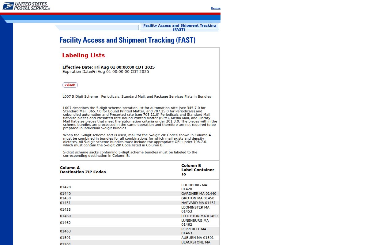
Read the primary code and its associated codes together, then return to the full street address. A box or finance code should never be plotted as though it covered a residential neighborhood.
Orleans Portals and ZIP Fields
Local systems do not share one ZIP-wide search. Property Viewer accepts address, owner, or tax bill, but no verified public ZIP export. The Louisiana Voter Portal accepts ZIP as one identity field along with name and birth month and year; it does not expose every voter in that code. One Stop basic search uses address, name, or reference, while its documented advanced fields focus on record types, council district, keywords, and dates.
City GIS can browse parcels and service boundaries, yet the inspected parcel layer did not confirm a ZIP filter. This gap matters. Do not claim that a map or roll lists all Orleans residents by ZIP. Verify one address at a time, or submit a lawful, focused request to the appropriate custodian.
Search limit. A ZIP narrows geography, but no reviewed Orleans portal produced a complete public ZIP-wide resident export.
Historic Orleans Addresses Predate ZIPs
A nineteenth-century address cannot be searched by modern ZIP code. City Archives says New Orleans converted to the present street-number system in the early 1890s. Its conversion tables use old and new names, municipal districts, cross streets, old numbers, and new hundred-block references, but they do not always yield one exact modern number.
Street-name tables cover changes from 1852 through 1938, with stated gaps. For an old resident, identify the historic street, cross street, square, municipal district, lot, and deed description. Then use directories, maps, and land records. Adding a modern ZIP too early can attach the right name to the wrong block.
Use Orleans Geography Carefully
Neighborhood shorthand remains helpful when the evidence is labeled. Vieux Carré, Algiers, Carrollton, Gentilly, Lakeview, Bywater, and New Orleans East can guide a reader toward a likely ordinary code. They are not postal boundaries, and local identity often crosses a delivery line.
For every Orleans Parish ZIP code directory result, retain four separate fields: postal city, five-digit ZIP, situs parish, and parcel address. Add ZIP+4 or carrier route only when USPS returns it. That small record prevents the two main errors: treating Jefferson addresses labeled New Orleans as Orleans Parish, and excluding West Bank Orleans addresses because they sit across the river.
Note: Postal geography organizes delivery, while parish, parcel, ward, square, and municipal district control different official records.
A careful search log should record the date of the USPS check, the exact address entered, the standardized result, and the parcel source used for jurisdiction. If postal and parcel fields disagree, keep both. Ask the City Addressing Division about a municipal-address change when a current deed, utility reference, and GIS card do not align. Its 2026 routing form shows that an update may pass through the postmaster, Assessor, planning staff, water utility, and other agencies. A new address can therefore reach each public system at a different time.